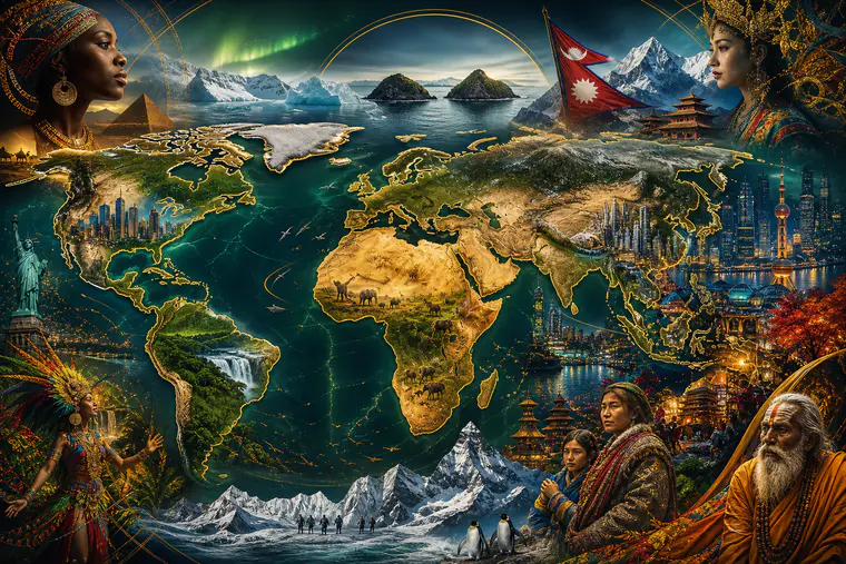
Why These Facts Matter (and Make Great Trivia)
Global trivia isn’t just party chatter—it’s a shortcut to understanding how our planet really works. A handful of counterintuitive facts can fix common map myths, sharpen your sense of scale, and give you memorable stories for your next quiz night. Below you’ll find mind-bending truths about population patterns, borders and time zones, flags and languages, deserts and lakes, plus practical tips to remember them.
Population Patterns That Reframe the Map
Most people don’t live where you think
- Nearly all of humanity lives in the Northern Hemisphere. This simple truth explains why many global events, holidays, and broadcast schedules feel “north-centric.”
- More than half the world’s people live in Asia. That’s not just China and India; it includes densely populated nations like Indonesia, Pakistan, Bangladesh, Japan, the Philippines, and Vietnam. If you picture world population as a heat map, most of the glow is in South and East Asia.
- Humanity is now a city-dwelling species. Most people live in urban areas, a shift that happened within the last couple of decades. That means “global problems” often have urban solutions—think transit, housing, and air quality.
Trivia tip: Remember NUMA—Northern, Urban, Mega-Asia. It captures three population realities in four letters.
The tiny circle that contains billions
There’s a famous thought experiment: draw a circle centered roughly over the South China Sea big enough to include eastern China, the Koreas, Japan, Taiwan, the Philippines, Vietnam, Thailand, Malaysia, Singapore, Indonesia, and parts of India, Bangladesh, and Myanmar. More people live inside that circle than outside it. It’s a perspective-reset about where humanity actually resides.
Geography Truths Your Map Hid from You
Africa is much bigger than you’ve been shown
Most classroom maps use the Mercator projection, which stretches land near the poles and shrinks regions around the equator. Result: Greenland looks rival-sized to Africa. In reality, Africa is roughly 14 times larger than Greenland. You can fit the United States, China, India, and much of Europe into Africa with room to spare. If you want a truer sense of scale, try an equal-area map projection like Gall–Peters or Mollweide.
Memory hook: “Africa = A Grand Arena.” Think “arena” for scale—so big that other giants can fit inside.
Deserts aren’t just hot
We call a place a desert when it’s dry, not when it’s hot. By that definition, Antarctica is the largest desert on Earth. The Sahara is the largest hot desert. This helps explain why deserts exist on every continent, from the Atacama in South America to the Gobi in Asia.
Borders that defy expectations
- The United States and Russia are neighbors. At their closest, the Diomede Islands in the Bering Strait are only a few kilometers apart—close enough to see across on a clear day.
- Two countries are “double landlocked,” meaning they’re surrounded entirely by landlocked countries: Liechtenstein and Uzbekistan. To reach the sea from either, you must cross at least two national borders.
- China and Russia each border 14 countries, tying them for the most land neighbors.
Quiz prompt: “Name the only two double-landlocked countries.” If players get one, challenge them to reason out the other based on maps.
Time Zones and Borders That Play Tricks
One big country, one official time
China spans five geographical time zones but uses just one official time (Beijing time). That means sunrise and sunset can feel wildly misaligned depending on where you are. It’s a neat reminder that time zones are political as much as geographic.
Not all time zones jump by the hour
Most time zones are offset from Coordinated Universal Time (UTC) by whole hours, but some aren’t. Nepal uses UTC+5:45. Parts of Australia use half-hour offsets. New Zealand’s remote Chatham Islands even use UTC+12:45. File these away for time-zone trivia rounds.
Capitals that share the spotlight
- South Africa has three capital cities with different roles: Pretoria (executive), Cape Town (legislative), and Bloemfontein (judicial).
- Bolivia recognizes Sucre as its constitutional capital, while the seat of government is in La Paz, which also holds the title of world’s highest seat of government.
- The Netherlands lists Amsterdam as the capital, but the government sits in The Hague.
Quiz prompt: “Which country has three capitals serving different branches of government?” A perfect mid-round stumper.
Water, Lakes, and the Planet’s Hidden Extremes
Rivers aren’t universal
Some countries have no permanent rivers. The largest by area is Saudi Arabia, where seasonal wadis carry water only after rare rains. It’s an excellent example of how human settlements adapt to arid environments with wells, desalination, and careful water management.
Lake logic
Canada is the global heavyweight for lake count, with an extraordinary number of large and small lakes carved by ancient ice. Finland’s nickname—“Land of a Thousand Lakes”—barely hints at the reality that it has far more than a thousand. If you enjoy map-based trivia, lake-dense regions are goldmines for questions about shorelines and islands.
Where Earth’s water really is
Only a small fraction of the planet’s freshwater sits in rivers and lakes. The vast majority is locked up in ice and underground aquifers. That’s why glaciology and groundwater science matter so much for long-term water security.
Language, Culture, and Flags That Surprise
A world of languages in one country
Papua New Guinea is home to more languages than any other country—hundreds of them—reflecting steep terrain, island isolation, and rich cultural diversity. Nigeria also boasts remarkable linguistic variety across its regions. When somebody says “they speak Papua New Guinean,” you’ve got your quiz correction ready: there isn’t one; there are many.
The most-spoken native tongues
While counts shift over time, Mandarin Chinese, Spanish, English, Hindi, and Arabic are consistently among the most-spoken native languages. Knowing that lineup will help you navigate many “top five” language questions.
Reading direction and writing systems
Not all scripts read left-to-right. Arabic and Hebrew are read right-to-left; traditional Mongolian is written in vertical columns. East Asian scripts historically used vertical writing, and you’ll still see it in calligraphy and signage. Perfect fodder for visual rounds.
Flag facts to remember
- Nepal’s flag is the only national flag that isn’t rectangular; it’s made of two stacked pennants.
- Paraguay’s flag has different designs on its front and back.
- Purple is rare on national flags because the dye historically cost a fortune; by the time synthetic dyes became cheap, many flags were already established.
Nature and Earth Science That Bend Intuition
The tallest mountain depends on where you start measuring
Mount Everest is the highest point above sea level. But measured from base to peak, the champion is Mauna Kea in Hawaii—its base rests deep on the ocean floor, making the total height greater than Everest’s. There’s also a curveball: due to Earth’s equatorial bulge, Mount Chimborazo in Ecuador is the farthest point from Earth’s center, even though it’s not as high above sea level as Everest.
The longest border and the loneliest neighbor
The Canada–United States border is the world’s longest international boundary. Canada is also the largest country that borders only one nation, a fun paradox that sticks once you’ve seen a North American map.
Biologically rich “clubs”
Scientists sometimes label certain nations as “megadiverse”—countries that hold an outsized share of Earth’s species. Think Brazil, Indonesia, Australia, Mexico, the Democratic Republic of the Congo, and a handful of others. If a quiz asks where the most species of something live, betting on a tropical, megadiverse country is often wise.
Quick One‑Liners to Stump Your Smartest Friend
- Antarctica is the world’s largest desert; the Sahara is the largest hot desert.
- Two countries are double landlocked: Liechtenstein and Uzbekistan.
- China and Russia each border 14 countries.
- The US and Russia are only a few kilometers apart at the Diomede Islands.
- Nepal’s flag is the only non‑rectangular national flag.
- Papua New Guinea leads the world in number of languages.
- Canada–USA is the world’s longest international border.
- Mauna Kea is the tallest mountain from base; Everest is highest above sea level.
- Most humans live in the Northern Hemisphere and in cities.
- A small circle in Asia contains more people than the rest of the world combined.
Use these as lightning-round questions or as multiple‑choice stems with cleverly wrong distractors.
Turn These Facts Into Unforgettable Quiz Games
1) Map mashups
- Print an equal‑area world map and cut out Africa. Ask teams to place paper cutouts of India, China, the US, and parts of Europe inside it without overlaps. Award points for accurate fits. This visualizes scale better than any lecture.
2) Time‑zone relay
- Create cards with city names and UTC offsets (include trick cards like Nepal’s +5:45 or Chatham Islands +12:45). Teams race to place them in the correct order. Bonus for identifying countries with a single national time despite huge width (China).
3) Flag forensics
- Show silhouettes of flags (no colors). See who can identify Nepal, Switzerland, and non-rectangular pennants. Add a twist by showing Paraguay’s obverse vs. reverse.
4) Language labyrinth
- Give teams a list of languages and challenge them to match each to a country with high diversity (Papua New Guinea, Nigeria) or to writing direction (Arabic, Hebrew, Mongolian). Add visual examples of scripts for a multimedia round.
5) Desert or not?
- Present images of Antarctica, the Atacama, the Gobi, and a sandy beach. Ask which qualify as deserts and why. Emphasize precipitation over temperature.
6) Memory anchors that stick
- Turn facts into tiny stories. “A hiker stands on Mauna Kea’s summit but most of the mountain sleeps underwater.” Stories beat raw numbers for recall.
Pro tip: Use a spaced‑repetition app to drip these facts into your long‑term memory. Ten cards a day for two weeks and you’ll feel like a walking atlas.
Practical Ways to Learn (and Teach) Global Facts
- Compare map projections: Use an interactive map that lets you drag countries over others to see true size. After five minutes of play, Greenland will never fool you again.
- Build themed trivia nights: One week on time zones and borders, the next on flags and languages. Repetition with variety cements knowledge.
- Create personal mnemonics: NUMA (Northern, Urban, Mega‑Asia) and “Mauna > Measure” (for base‑to‑peak height) are examples. Invent your own.
- Teach with contrasts: Pair a myth with a correction—“Greenland vs. Africa”—to make the real fact stick.
- Keep a “Did you know?” journal: A sentence per day becomes a ready‑made question bank in a month.
Frequently Asked Questions
Are these facts stable, or do they change over time?
Some, like Africa’s true size or Nepal’s flag shape, are rock‑solid. Others—like language speaker counts or city populations—shift gradually. For quiz writing, avoid exact, fast‑changing numbers unless you have a current source and a date attached.
What’s the best way to remember a lot of global facts?
Use spaced repetition for quick reviews, group facts into themes (maps, time zones, flags), and create vivid mini‑stories. Short, daily practice beats cramming.
Why do world maps make places look wrong?
Most maps trade accuracy of area, shape, or distance for readability. Mercator keeps compass bearings straight but inflates regions near the poles. Equal‑area projections preserve size, which helps for scale questions.
How can I make trivia fair for all players?
Mix question types (multiple‑choice, picture rounds, map tasks), balance easy and hard items, and rotate topics across regions and cultures. Offer hints that reward reasoning, not just memorization.
Approved member comments will appear here.